|
|
Post by Lensman on Feb 6, 2007 2:33:59 GMT 1
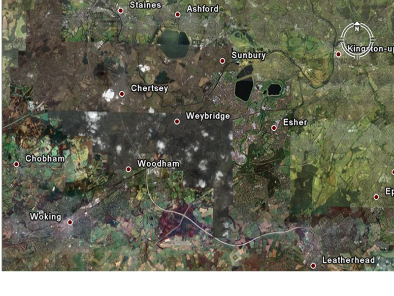
I remember on the old board that someone posted a map, or a link to a map, showing the area of the Martian Invasion. Can anyone supply a copy of that?
|
|
|
|
Post by andy120290 on Feb 6, 2007 2:53:34 GMT 1
|
|
|
|
Post by Commandingtripod on Feb 6, 2007 10:35:42 GMT 1
Adding to it, though I don't quite know if you need it, here's a Google Earth photo I managed to pull up of the area around Woking.  I don't really think that it's what you're after but it's there all the same.  |
|
|
|
Post by andy120290 on Feb 6, 2007 21:25:00 GMT 1
I think that the problem with using Google Earth is that it shows the area now, not how it looked around the turn of the century.
|
|
|
|
Post by Commandingtripod on Feb 7, 2007 9:08:43 GMT 1
I think that the problem with using Google Earth is that it shows the area now, not how it looked around the turn of the century. True. Although it does give you the locations of the towns and such. |
|
|
|
Post by killraven on Feb 7, 2007 18:00:33 GMT 1
I think that the problem with using Google Earth is that it shows the area now, not how it looked around the turn of the century. That could have something to do with Google Earth not existing at the turn of the 20th century!  Sorry, Smirk Mode Off/ ;D KR |
|
|
|
Post by leatherhead on Feb 8, 2007 2:14:22 GMT 1
a little OT. I've noticed that the program "Google Earth" has an inaccuracy. At the bootom right the program gives you "Eye Altitude", basicly what you would see from however far zoomed in or out you are on the map. This seems like it is inaccurate. anyone with the program can check. Zoom into 35,000 feet: the cruising altitude of most commercial aircraft, when the eye altitude says 35,000 feet, it certainly looks MUCH farther up than that,more like 100,000 feet or so. Just an observation. Try it out.
|
|
|
|
Post by Lensman on Feb 8, 2007 2:57:41 GMT 1
|
|
Rob
Trainee
 
Posts: 52
|
Post by Rob on Feb 12, 2007 15:05:44 GMT 1
Wow I've never seen that, very interesting.
|
|